
Berkeley Castle, whose origins date to the 11th century, can be found on the outskirts of the town of Berkeley, Gloucestershire and is traditionally believed to be the scene of the murder of King Edward II.
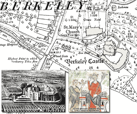
The map shown above is a 1:2,500 county series map from 1880
Edward’s reign was marked by alleged incompetence, political squabbling and military losses including the devastating defeat at Bannockburn in 1314. He was eventually overthrown by his wife Isabella of France and Roger Mortimer, an exiled opponent of Edward, in favour of Isabella’s son who was crowned Edward III in January 1327.
After Edward II was deposed in 1326 he was exiled to Berkeley Castle, where in late September 1327, after a failed escape, he was reputedly murdered by means unknown. Although popular stories of a red hot poker or suffocation persist, some commentators have claimed that Edward’s escape was actually successful, and that someone else was later murdered in his place. Whatever the truth, much of the original fabric of Berkeley Castle still stands as a reminder of the last days of one of England’s Plantagenet kings.
