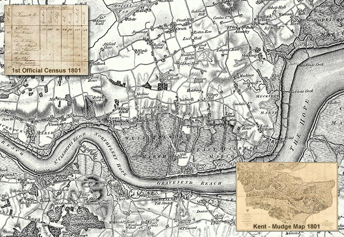
Map: Thames Estuary (OS Old Series 1:50,000 – Published 1805)
The history of the Ordnance Survey’s mapping began in 1791 when the government, fearful of the threat of an invasion by French revolutionary forces, instructed the then Board of Ordnance to make a detailed survey of the vulnerable southern regions of England.
At the beginning of the nineteenth century some maps at the one-inch (1:63,360) scale based on Board of Ordnance surveys were already available to the public, including Kent (1801 – the ‘Mudge map’). The first published by the Ordnance Survey itself was the map of Essex which appeared in 1805. This was the start of a nationally (England & Wales) numbered map series, which later became known as the ‘Old Series’.
On the 10th March 1801, the same year as the ‘Mudge Map’ of Kent was published, the first official census was held in Britain.
Objections were raised as some felt that the census was aimed at extracting revenue. Others feared that in the era of the Napoleonic Wars the information would inevitably see its way into the hands of the enemy, allowing Bonaparte to plan an invasion of the British Isles.
By 1800 the need for a census had become greater than the resistance to it. Talk of population growth outstripping the ability of the country to feed that population was a forceful argument in favour of compiling the statistics.
Thus the Census Act of 1800 was passed on 3rd December 1800, receiving royal assent on the 31st December and the census was carried out on Monday March 10th 1801.
Estimates of the size of the population varied from 8 million to 11 million. The actual figures proved to be: 8.3 million people in England – women outnumbering men by 300,000; the Welsh population was 542,000; and Scotland 1.6 million. Thus the total population at the beginning of the 19th century was officially recorded as 10.4 million.
Find out about the history of your area. Visit Cassini Maps