Rochdale Equitable Pioneers Society AKA the CO-OP

A-toadlane

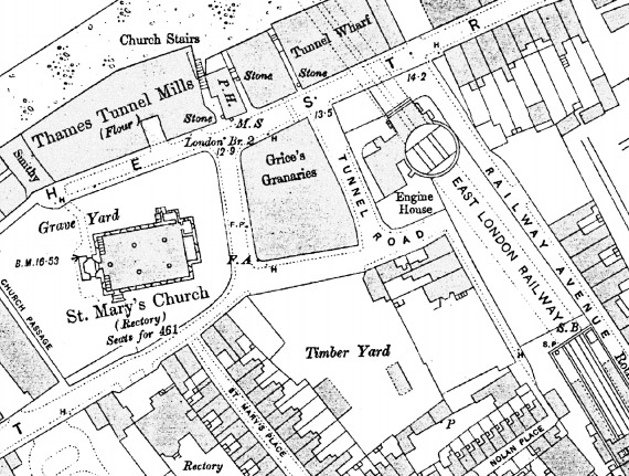
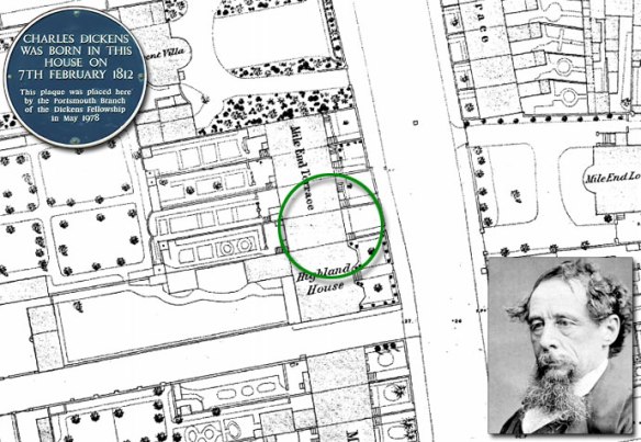
Map: Ordnance Survey Town Plan 1:500 first published 1908

The Rochdale Society of Equitable Pioneers was a group of 28 that was formed in 1844. The society was made up from a variety of local trades with more than half involved in the production of textiles  – ten of them flannel weavers whilst others were cloggers, shoemakers, joiners or cabinet makers, but they united in common cause against the oppressive poverty facing their community in 1840s Rochdale.

As mechanisation forced more and more skilled workers into poverty, these tradesmen decided to band together to open their own store selling food items they could not otherwise afford. With lessons from prior failed attempts at co-operation in mind, they designed the now famous Rochdale Principles, and over a period of four months they struggled to pool £1 per person for a total of 28 pounds of capital. On 21 December 1844, they opened their store in 31 Toad Lane with a very meagre selection of butter, sugar, flour, oatmeal and a few candles. Within three months, they expanded their selection to include tea and tobacco, and they were soon known for providing high quality, unadulterated goods. Ten years later, the British co-operative movement had grown to nearly 1,000 co-operatives. Although other co-operatives had preceded them, the Rochdale Pioneers’ co-operative became the prototype for societies in Great Britain.

A visitors book was kept in Toad Lane from the 1860s and shows the range of their influence. By 1862 German, Spanish and Russian visitors had made their way to Rochdale to see how a successful co-operative was run. The following year Alexander Campbell, the Scottish Owenite and originator of the dividend signed the book. The first Japanese signatory was Tomizo Noguchi in 1872.

Rochdale Pioneers traded independently until 1991, with name changes inspired by mergers with neighbouring co-operatives, finally ending up today as the The Co-operative Group.

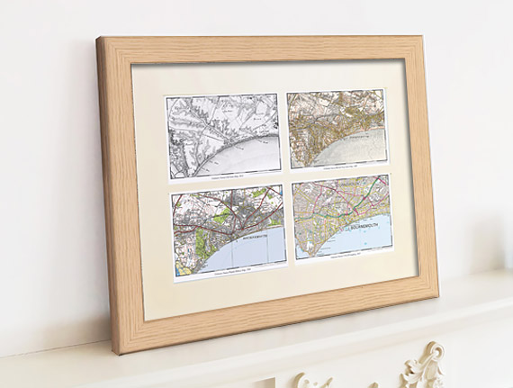
To find maps of your are visit Cassini Maps

Shakespear’s birthplace

shakespear2

Shakespear’s birthplace, Henley Street.  (MAP: 1886 – Town Plan, Scale: 1:500)

Shakespeare’s Birthplace is a 16th-century half-timbered house situated in Henley Street, Stratford-upon-Avon, Warwickshire, where it is believed that William Shakespeare was born in 1564 and spent his childhood years. Shakespeare is also known to have spent the first five years of married life in this house with his new wife, Anne Hathaway.

The house itself is relatively simple, but for the late 16th century it would have been considered quite a substantial dwelling. John Shakespeare, William’s father, was a glove maker and wool dealer, and the house was originally divided in two parts to allow him to carry out his business from the same premises.

The building is typical of the times and was constructed in wattle and daub around a wooden frame. Local oak from the Forest of Arden and blue-grey stone from Wilmcote were used in its construction, while the large fireplaces were made from an unusual combination of early brick and stone, and the ground-floor level has stone-flagged floors.

The plan of the building was originally a simple rectangle. From north-west to south-east, the ground-floor consisted of a parlour with fireplace, an adjoining hall with a large open hearth, a cross passage, and finally a room which probably served as John Shakespeare’s workshop. A separate single-bay house, now known as Joan Hart’s Cottage, was later built onto the north-west end of the house, and the present kitchen was added at the rear with a chamber above it.

The ownership of the premises passed to William on John Shakespeare’s death.

William already owned his own property in Stratford and had no need for the Henley Street premises as a home for himself or his family. Consequently, the main house was leased to Lewis Hiccox, who converted it into an inn known as the Maidenhead (later the Swan and Maidenhead Inn).

Under the terms of Shakespeare’s will, the ownership of the whole property (the inn and Joan Hart’s cottage) passed to his elder daughter, Susanna, upon his death.

In 1649 it passed to her only child, Elizabeth, and then in 1670 to Thomas Hart. Hart was the descendant of Shakespeare’s sister, Joan, whose family had continued as tenants of the smaller house after her death in 1646. The entire property remained in the ownership of the Harts until 1806.

Find out about the history of your area. Visit Cassini Maps

Charles Dickens birthplace

dickens

Map: County Series town Plan 1:500 – published 1874

Charles Dickens birthplace

Charles John Huffam Dickens was born at 1 Mile End Terrace (now re-named 393 Old Commercial Road), a secluded and peaceful area of victorian and regency buildings, on 7th February 1812. When Dickens was born, Britain’s Navy was still at war with Napoleonic France and Charles’s father, John Dickens worked as a clerk in the Navy Pay Office.

This was his parents first home and they were to remain in Portsmouth until the winter of 1814 when his father was recalled to London. Charles later remembered that when they left the town it was covered in snow.

Dickens completed the first of his Christmas stories, A Christmas Carol in just six weeks, with the final pages written in early December of 1843. The story met with instant success and critical acclaim and the phrase “Merry Christmas” was popularised following the appearance of the story and has remained as part of Christmas around the world ever since.

Merry Christmas from Cassini.
Discover maps of your area. Visit Cassini Maps

Map of the month – Rugby, men and odd shaped balls.

Rugby School

Rugby School, Warwickshire (MAP: OS Town Plans 1:500 – published in 1887)

Nearly two centuries of Rugby’s history are written in the stones that stand around Rugby School, where in 1823 William Webb Ellis is said to have first picked up the ball and run, hence inventing the game of rugby football.

Although the evidence for the story is doubtful, it was immortalised at the school with a plaque unveiled in 1895.

Webb Ellis was born in Salford, Lancashire in November 1806. After the death of his father, his mother decided to move to Rugby, Warwickshire so that William and his older brother Thomas could receive an education at Rugby School with no cost as a local foundationer (i.e. a pupil living within a radius of 10 miles of the Rugby Clock Tower).

After leaving Rugby in 1826, he went to Brasenose College, Oxford. He played cricket for his college, and for Oxford University After graduation he entered the Church and became chaplain of St George’s Chapel, Albemarle Street, London and then rector of St. Clement Danes in The Strand.

He never married and died in the south of France in 1872. His grave in “le cimetière du vieux château” at Menton in Alpes Maritimes was rediscovered by Ross McWhirter in 1958 and has since been renovated by the French Rugby Federation.

The players then were more numerous: in 1839, when Queen Adelaide visited the School, it was School House versus The Rest.  The School House team numbered 75 boys and The Rest 225.

A significant event in the early development of rugby football was the production of the first written laws of the game at Rugby School in 1845, which was followed by the ‘Cambridge Rules’ drawn up in 1848 leading to the formation of the Rugby Football Union in 1871.

The code was originally known as “rugby football”; it was not until after the schism in England in 1895, which resulted in the separate code of rugby league, that the sport took on the name “rugby union” to differentiate it from the league game. Despite the sport’s full name of rugby union, it is known simply as rugby throughout most of the world.

Despite the doubtful evidence, the current Rugby World Cup trophy is named after Webb Ellis.

Find out about the history of your area. Visit Cassini Maps

Map of the month – Botchergate, Trollope and the Bellman

First Postbox - CarlisleBotchergate, Carlisle (MAP: OS Town Plans 1:500 – published in 1865)

vertical-pillarbox

Thirteen years after Sir Rowland Hill, Secretary of the Post Office, introduced the Penny Post that the first mainland Pillar Box was erected in Botchergate, Carlisle in 1853.

The advent of the British wayside letter box can be traced to Sir Rowland Hill and his Surveyor for the Western District, and noted novelist, Anthony Trollope (known for The Warden, Barchester Towers and the Palliser novels).

Before 1853 it was customary to take outgoing mail to the nearest letter receiving house or post office, where the Royal Mail coach would stop to pick up and set down mail and passengers. People would take their letters in person, or in some areas they could await the appearance of the Bellman. The Bellman wore a uniform and walked the streets collecting letters from the public while ringing a bell to attract attention.

In 1852 Anthony Trollope was sent by Rowland Hill to the Channel Islands to ascertain what could be done about the problem of collecting the mail on the islands. To post a letter in Jersey or Guernsey, the post had to be taken down to the quayside and handed to the Master of the Royal Mail steamer in person. This was a somewhat inconvenient practice, subject as it was to the uncertainties of weather and tides.

Trollope’s recommendation back to Hill was to employ a device he had probably seen in Paris: a “letter-receiving pillar”. The first pillar boxes was brought into public use on Jersey in late November 1852 and they were an instant success.

By the next year the idea had spread to mainland Britain, with England’s first pillar box erected at the corner of Botchergate and South Street in Carlisle. In basic form all boxes were vertical cast iron ‘pillars’ with a small vertical slit to receive letters, but by 1857, after experimenting with various designs, horizontal, rather than vertical, slots were taken as a standard. The Committee responsible for the standardisation designed a very ornate box festooned with Grecian style-decoration but, in a major oversight, devoid of any posting aperture, which meant the slots were chiselled out of the cast iron by local craftsmen, usually destroying the look of the box.

Prior to 1859 colours varied until a bronze green colour was chosen as the new standard, which was to last until 1874. Initially it was thought that the green colour would be unobtrusive. Too unobtrusive, as it turned out — people kept either walking into them or past them. Red became the standard colour in 1874, although ten more years elapsed before every box in the UK had been repainted.

Find out about the history of your area. Visit Cassini Maps


Cassini Maps Sale – 25% OFF!

Cassini Quad Map

Last few days of this Special Offer! – 25% Off all maps (ends 30th Sept 2015)
Use the code C-SUN15 to claim your Discount.

Simply enter the code when prompted during checkout. P&P applies as normal.
Offer applies to all maps available on www.cassinimaps.co.uk
Including our Quad maps (4 maps of the same location but from diferent time periods) as shown above.

New! – Cassini brings you Ordnance Survey’s most detailed historical mapping.
Cassini’s Town Plan mapping is the most detailed historical Ordnance Survey mapping available. Easy to find and download.
Town Plan Map

Maps published from the mid 1800’s to the 1920’s
• Instant downloads only £9.99 (RRP:£14.99)
• Ideal for Family History research
• Choose maps from 468 available Towns
• Amazing detail – 1:500, 1:528 and 1:1056 scales (dependent on location)

These maps were published for larger towns and cities at scales of 1:500, (c.10′ to 1 mile), 1:528 (exactly 10′ to 1 mile) and 1:1056 (5′ to 1 mile) from the mid 1800’s onwards. An immense amount of detail is shown, down to every lamp-post and every pillar-box, even paths, trees and sheds in peoples gardens. For those who are particularly interested in local history and genealogy, the town plans are essential research tool.

Find maps of your area on the Cassini Maps website Town Plan Maps

New Town Plans – 50% Off.

Ordnance Survey’s most detailed historical mapping

Town Plans Special Offer

Published from the mid 1800’s to the 1920’s

• Instant downloads only £7.49 (RRP:£14.99)
• Ideal for Family History research
Choose from 468 available Towns
• Amazing detail – 1:500, 1:528 and 1:1056 scales

These maps were published for larger towns and cities at scales of 1:500, (c.10′ to 1 mile), 1:528 (exactly 10′ to 1 mile) and 1:1056 (5′ to 1 mile) from the mid 1800’s onwards. An immense amount of detail is shown, down to every lamp-post and every pillar-box, even paths, trees and sheds in peoples gardens.

Cassini’s Town Plans are the most detailed historical Ordnance Survey maps available and are easy to find and download. For those who are particularly interested in local history and genealogy, the town plans are essential research tool – now half price.

See Town Plans for your area, or find other scales and map products.

Ballot Box, Balls and a Roman

Ballot Street, Smethwick (MAP: OS Town Plans 1:500 – published in 1887)
Ballot - Town Plan Maps

The map above is an example of one of Cassini’s newly available Town Plans. A great number of English towns, those with a population of over 4,000, were surveyed on the large scale of 1:500. Other early plans were published at scales of 1:528 and 1:1056, but from 1855 onwards the scale of 1:500 was settled on and most were surveyed only once. The maps, published between 1855 and 1920’s, show an immense amount of detail, down to every lamp-post and every pillar-box, even paths, trees and sheds in peoples gardens.

As we have chosen Ballot Street, here’s a bit of history you may, or may not, know. A ballot is a device used to cast votes in an election. It was originally a small ball used to record decisions made by voters. The word ballot comes from Italian ballotta, meaning a “small ball used in voting”. The first use of paper ballots to conduct an election appears to have been in Rome in 139 BC.

The coin shown above is Roman from around 63 B.C. Issued by Cassius Longinus, who became a proconsul in 48 B.C. and a Tribune of the Plebs in 44 B.C. The reverse of the coin shows a voter about to deposit a voting tablet marked V (meaning yes – ‘as you ask’) into a voting urn.

The first British secret ballot using ballot papers and a ballot box was held in Pontefract on 15 August 1872, under the terms of the recently enacted Ballot Act 1872. In a ministerial by-election following his appointment as Chancellor of the Duchy of Lancaster, Hugh Childers was re-elected as MP for Pontefract. The original ballot box, sealed in wax with a liquorice stamp, can still be seen in Pontefract Museum.

Find out about the history of your area. Visit Cassini Maps

Zeppelin Raids – The birth of the Blitz.

St. Peter’s Plain, Great Yarmouth (MAP: OS Town Plans 1:500 – published in 1885)
Zeppelins over Great Yarmouth

2015 marks the 100th anniversary of the first Zeppelin air raids on the UK.

On the 19th January 1915 two Zeppelin naval airships, 190 metres long, were heading for Humberside but were blown further down the east coast by strong gusts. They were forced to switch their attacks to the coastal towns of Norfolk. Zeppelins L3 and L4 crossed the coast of East Anglia, north of Great Yarmouth. Zeppelin L4 flew on towards Kings Lynn while Zeppelin L3, piloted by Kaptain Lt. Hans Fritz, turned back towards Great Yarmouth.

The first bomb dropped by L3 was an incendiary which landed in a waterlogged field in Little Ormesby, the second fell on a lawn in Albermarle Road near Wellesley. The first explosive to be dropped struck the pavement in Crown Road, but failed to explode, but the fourth and most destructive of the bombs to land on Great Yarmouth fell in St Peter’s Plain and burst with devasstating effect instantly killing Martha Taylor and shoemaker Sam Smith, while two more people were injured. By the end of the night two more people had been killed in Kings Lynn.

By the end of the First World War Zeppelin’s and other airships made about 51 bombing raids on England, killing 557 and injured another 1,358 people. More than 5,000 bombs were dropped on towns across Britain, causing £1.5 million in damage. 84 airships in all took part, of which 30 were lost, either shot down or lost in accidents. At the start of the war there were few weapons capable of combatting the Zeppelin threat. Conventional bullets would pass harmlessly through the aluminium frame and gas-bags. Not until the invention of incendiary bullets was there an effective way of bringing the Zeppelins down.

This first raid marked a change in the face of conflict, with the bombings serving as a forewarning of what was to come during the Blitz in the Second World War.

Find out about the history of your area. Visit Cassini Maps