10% OFF – CHRISTMAS SALE

C-XMAS17

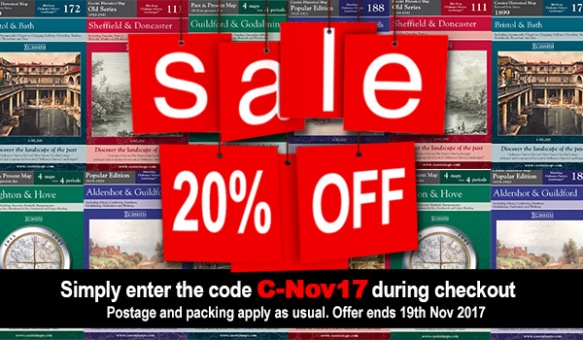
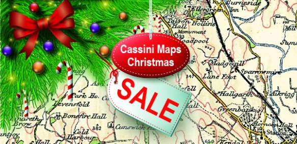
CHRISTMAS SALE – 10% OFF ALL MAPS

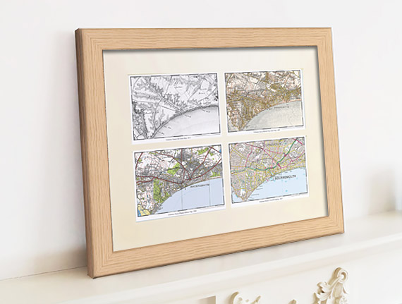
• Cassini Maps make Ideal Gifts for all the family.
• Order now! Last chance before for Christmas!
• A great way to compare the past with the present
• For anyone with an interest in history: friends, family or even treat yourself
• Simply use the code C-XMAS17 when prompted during checkout to receive your 10% discount. Postage and package applies as normal.

Happy Christmas from Cassini

Visit www.cassinimaps.co.uk now and see which maps we have available for your area. Buy them for yourself or make a present of the past to someone in your life.

Regards

Cassini Publishing Ltd.

November Sale – 20% OFF!

Cassini Maps Sale November 2017
Diverting, decorative and practical presents for anyone with any interest in the past.
Personalised maps centred on the location of your choice.

• Ideal gifts for Christmas
• For your friends or relatives or even for yourself!
• Maps for England, Wales, Scotland and Ireland
• Folded Maps, Deluxe Framed Maps, Classic Frame, Canvases, Downloads, Town Plan Maps, Parish Maps, Mugs…

Use coupon code C-Nov17. Simply enter the code when prompted during checkout.

Visit www.cassinimaps.co.uk

(Valid until 19th November 2017. P&P applies as normal.)

Cassini Maps Sale – 25% OFF!

Cassini Quad Map

Last few days of this Special Offer! – 25% Off all maps (ends 30th Sept 2015)
Use the code C-SUN15 to claim your Discount.

Simply enter the code when prompted during checkout. P&P applies as normal.
Offer applies to all maps available on www.cassinimaps.co.uk
Including our Quad maps (4 maps of the same location but from diferent time periods) as shown above.

New! – Cassini brings you Ordnance Survey’s most detailed historical mapping.
Cassini’s Town Plan mapping is the most detailed historical Ordnance Survey mapping available. Easy to find and download.
Town Plan Map

Maps published from the mid 1800’s to the 1920’s
• Instant downloads only £9.99 (RRP:£14.99)
• Ideal for Family History research
• Choose maps from 468 available Towns
• Amazing detail – 1:500, 1:528 and 1:1056 scales (dependent on location)

These maps were published for larger towns and cities at scales of 1:500, (c.10′ to 1 mile), 1:528 (exactly 10′ to 1 mile) and 1:1056 (5′ to 1 mile) from the mid 1800’s onwards. An immense amount of detail is shown, down to every lamp-post and every pillar-box, even paths, trees and sheds in peoples gardens. For those who are particularly interested in local history and genealogy, the town plans are essential research tool.

Find maps of your area on the Cassini Maps website Town Plan Maps

New Town Plans – 50% Off.

Ordnance Survey’s most detailed historical mapping

Town Plans Special Offer

Published from the mid 1800’s to the 1920’s

• Instant downloads only £7.49 (RRP:£14.99)
• Ideal for Family History research
Choose from 468 available Towns
• Amazing detail – 1:500, 1:528 and 1:1056 scales

These maps were published for larger towns and cities at scales of 1:500, (c.10′ to 1 mile), 1:528 (exactly 10′ to 1 mile) and 1:1056 (5′ to 1 mile) from the mid 1800’s onwards. An immense amount of detail is shown, down to every lamp-post and every pillar-box, even paths, trees and sheds in peoples gardens.

Cassini’s Town Plans are the most detailed historical Ordnance Survey maps available and are easy to find and download. For those who are particularly interested in local history and genealogy, the town plans are essential research tool – now half price.

See Town Plans for your area, or find other scales and map products.

Special Offer – 30% Off all Cassini Maps

30% OFF! Easter Special OfferEaster Sale! – 30% Off all maps
Use the code C-EASTER15 to claim your 30% Discount.
Enter the code when prompted during checkout. P&P applies as normal.
Offer ends 10/04/2015

Maps for genealogy and local history
Whether you are tracing the history of your family or just interested in the local history you area, reliable conclusions are based on quality sources and maps have an important part to play in discovering where and how your ancestors lived.

Personalised Maps make ideal gifts
Diverting, decorative and practical presents for anyone with any interest in the past. For weddings, anniversaries, birthdays or Christmas; for your friends, your relatives – or even for yourself. Ideal as business gifts centred on your company location.

Map of the month – The Moon, Eclipse and Sun Rising

Moon, Shetland Isles Mainland – Map: Revised New Series 1:30,000 1911
Moon, Shetland Isles

The proportion of the sun covered by the moon in the Shetland Isles was expected to be 97% in today’s eclipse – not far off a total eclipse and was measured as the darkest place in the UK. The perfect place to have watched would have been Moon on the west coast of Shetland Mainland.

Records of solar eclipses have been kept since ancient times. Eclipse dates can be used for dating of historical records. A Syrian clay tablet records a solar eclipse which occurred on March 5, 1223 B.C. while a stone in Ireland is thought by some to record an eclipse in 3340 B.C. Chinese historical records of solar eclipses date back over 4,000 years and have been used to measure changes in the Earth’s rate of spin.

Places in the UK that reflect the main elements needed for an eclipse include the previously mentioned Moon in the Shetland Isles, Sun Rising in Warwickshire and Eclipse Street in Cardiff.

The UK will not experience a solar eclipse on this scale again until 2026 and there may be a lucky few, who are already born, who will live to see the next total eclipse in the UK in the year 2090.

To buy this map, or any Cassini map of your area, go to:  Cassini Maps

Mapmaker Plus – Price drop!

Create your own bespoke maps with Mapmaker Plus.

Mapmaker PlusNow available from £14.99

Large format maps supplied folded or rolled. A total combination of 13 map scales and series. Maps available from 1805 to the present day. Choose from seven OS Historical Map Series.

Now includes six present day Ordnance survey mapping series.

• Centred on a location of your choice            • Never be on the edge of a map again
• Ideal for creating your own walking maps   • Explore the past with a historical map

Check out Cassini Mapmaker Plus custom made maps: Mapmaker Plus

Old Parish Maps – Reduced to £5.99

Cassini Old Parish Map

One week Special Offer RRP £12.99 – Now only £5.99
Offer ends 16th Feb 2015

Cassini Maps has created 14,659 individual historical Parishes Maps, which form an essential resource for local history researchers, genealogists and historians. As parish boundaries have changed over time, its essential to know where your ancestors lived and to understand the landscape that shaped their lives.

• Parish Maps provide a direct link to Census and Parish Records.
• Download the PDF to view on screen and print at home.
• Parish boundaries as they were in 1911.
• Detailed Ordnance Survey mapping published between 1880 – 1910.
• Downloadable PDFs of English and Welsh Parishes.
• Scale: Street-level mapping – 1:10,000 (originally 1:10,560).

(Sample)  (Keys & Legends)

14,659 individual historical Parishes Maps are now available to download and to print at home. These maps provide a vital link to Parish Records and show in great detail the historical Parishes in which your ancestors lived and worked. Each maps is taken from the Ordnance Survey County Series 1:10,560 maps from the cusp of 19th and 20th centuries and show the Historical Parish Boundary as recorded at the time of the 1911 census.

To buy your Old Parish Maps please visit Cassini Maps

Historical Map downloads of Ireland – Half Price!

Cassini’s Irish downloadable maps from the mid to late 1800’s.
Cassini Historical Mapping of Ireland

From only £4.49! One week only. Offer available until 16th Feb 2015

• Instant map downloads of any area.    • Including personal inscription.
• Available for 3 historical OS series.     • Highly customisable.

Cassini is delighted to offer you our stunning range of historical Ordnance Survey maps of Ireland. Simply search for the area you are interested in, buy and download the PDF.

Whatever your interest in the past our historical maps are invaluable works of reference. Ideal for research, or print and frame for a personalised decorative map centred on the location of your choice.

Irish 6 Inch First Edition Downloads –  c. 1840’s
Ireland First Edition Downloads – c. 1860’s
Ireland Third Edition Downloads – c. 1900’s

Visit Cassini and find maps of Ireland.