
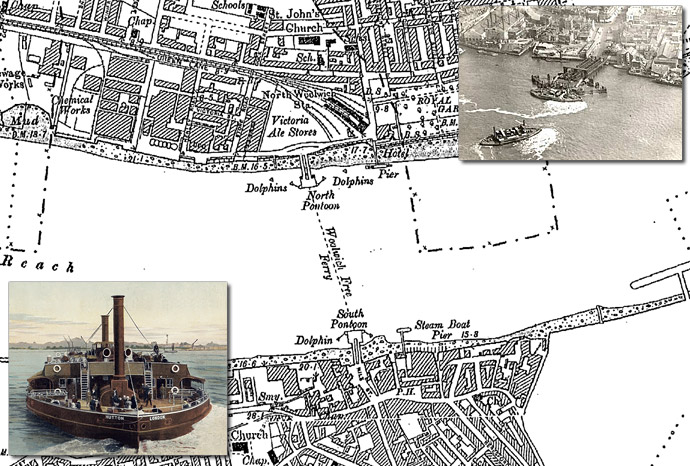
Woolwich and the Free Ferry – Map: County Series 1:2500 1894
The Woolwich Ferry (sometimes also called the Woolwich Free Ferry) is a free vehicle ferry service across the River Thames in East London. There has been a connection between what is now Woolwich and North Woolwich across the Thames since the Norman Conquest. The area was mentioned in the Domesday Book as 63 acres belonging to Hamon, the steward. There is also evidence of a ferry service in the area since the early 14th century. In the first half of the nineteenth century a commercial ferry operated in Woolwich between 1811 and 1844, but the company failed and the service ended.
In 1880 local pressure began for a renewal of such a service provided by the town authorities, but costs were prohibitive, and eventually the Metropolitan Board of Works was brought in to manage the embryonic project.
Following the establishment of the Metropolitan Board of Works, which had taken over toll bridges in west London and opened them to free public use, it was suggested that the Board should fund a free crossing of the Thames in east London. The service was instigated in September 1887 by Sir Joseph Bazalgette, famous for the significant impact he had both on London’s appearance and, through his design of an efficient sewage system, on the health of its inhabitants.
The service was officially opened on 23 March 1889, with the paddle steamer Gordon. Two days before the first service, the Metropolitan Board of Works was replaced by the London County Council (LCC), and the opening ceremony was conducted by Lord Rosebery instead of the expected Bazalgette.
The ferry typically attracts about two million passengers a year, although many cross-river foot passengers now take the foot tunnel beneath the river, alongside the ferry route. Further competition arrived in 2009 with the extension to Woolwich of the Docklands Light Railway, which crosses under the river to the east of the ferry route.
Sadly for history it seems inevitable that a bridge upstream of the ferry will be built, making crossing faster for the cars and lorries that use the service, with doubtless the demise of the ferry following the opening of that bridge.
To buy this map, or a Mapmaker Plus map of your area: Cassini Mapmaker Plus
