Map of the month – Botchergate, Trollope and the Bellman

First Postbox - CarlisleBotchergate, Carlisle (MAP: OS Town Plans 1:500 – published in 1865)

vertical-pillarbox

Thirteen years after Sir Rowland Hill, Secretary of the Post Office, introduced the Penny Post that the first mainland Pillar Box was erected in Botchergate, Carlisle in 1853.

The advent of the British wayside letter box can be traced to Sir Rowland Hill and his Surveyor for the Western District, and noted novelist, Anthony Trollope (known for The Warden, Barchester Towers and the Palliser novels).

Before 1853 it was customary to take outgoing mail to the nearest letter receiving house or post office, where the Royal Mail coach would stop to pick up and set down mail and passengers. People would take their letters in person, or in some areas they could await the appearance of the Bellman. The Bellman wore a uniform and walked the streets collecting letters from the public while ringing a bell to attract attention.

In 1852 Anthony Trollope was sent by Rowland Hill to the Channel Islands to ascertain what could be done about the problem of collecting the mail on the islands. To post a letter in Jersey or Guernsey, the post had to be taken down to the quayside and handed to the Master of the Royal Mail steamer in person. This was a somewhat inconvenient practice, subject as it was to the uncertainties of weather and tides.

Trollope’s recommendation back to Hill was to employ a device he had probably seen in Paris: a “letter-receiving pillar”. The first pillar boxes was brought into public use on Jersey in late November 1852 and they were an instant success.

By the next year the idea had spread to mainland Britain, with England’s first pillar box erected at the corner of Botchergate and South Street in Carlisle. In basic form all boxes were vertical cast iron ‘pillars’ with a small vertical slit to receive letters, but by 1857, after experimenting with various designs, horizontal, rather than vertical, slots were taken as a standard. The Committee responsible for the standardisation designed a very ornate box festooned with Grecian style-decoration but, in a major oversight, devoid of any posting aperture, which meant the slots were chiselled out of the cast iron by local craftsmen, usually destroying the look of the box.

Prior to 1859 colours varied until a bronze green colour was chosen as the new standard, which was to last until 1874. Initially it was thought that the green colour would be unobtrusive. Too unobtrusive, as it turned out — people kept either walking into them or past them. Red became the standard colour in 1874, although ten more years elapsed before every box in the UK had been repainted.

Find out about the history of your area. Visit Cassini Maps


Cassini Maps Sale – 25% OFF!

Cassini Quad Map

Last few days of this Special Offer! – 25% Off all maps (ends 30th Sept 2015)
Use the code C-SUN15 to claim your Discount.

Simply enter the code when prompted during checkout. P&P applies as normal.
Offer applies to all maps available on www.cassinimaps.co.uk
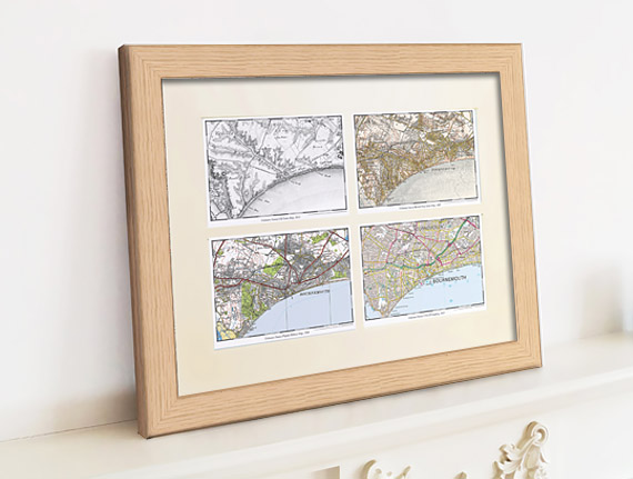
Including our Quad maps (4 maps of the same location but from diferent time periods) as shown above.

New! – Cassini brings you Ordnance Survey’s most detailed historical mapping.
Cassini’s Town Plan mapping is the most detailed historical Ordnance Survey mapping available. Easy to find and download.
Town Plan Map

Maps published from the mid 1800’s to the 1920’s
• Instant downloads only £9.99 (RRP:£14.99)
• Ideal for Family History research
• Choose maps from 468 available Towns
• Amazing detail – 1:500, 1:528 and 1:1056 scales (dependent on location)

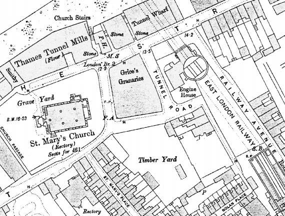
These maps were published for larger towns and cities at scales of 1:500, (c.10′ to 1 mile), 1:528 (exactly 10′ to 1 mile) and 1:1056 (5′ to 1 mile) from the mid 1800’s onwards. An immense amount of detail is shown, down to every lamp-post and every pillar-box, even paths, trees and sheds in peoples gardens. For those who are particularly interested in local history and genealogy, the town plans are essential research tool.

Find maps of your area on the Cassini Maps website Town Plan Maps

New Town Plans – 50% Off.

Ordnance Survey’s most detailed historical mapping

Town Plans Special Offer

Published from the mid 1800’s to the 1920’s

• Instant downloads only £7.49 (RRP:£14.99)
• Ideal for Family History research
Choose from 468 available Towns
• Amazing detail – 1:500, 1:528 and 1:1056 scales

These maps were published for larger towns and cities at scales of 1:500, (c.10′ to 1 mile), 1:528 (exactly 10′ to 1 mile) and 1:1056 (5′ to 1 mile) from the mid 1800’s onwards. An immense amount of detail is shown, down to every lamp-post and every pillar-box, even paths, trees and sheds in peoples gardens.

Cassini’s Town Plans are the most detailed historical Ordnance Survey maps available and are easy to find and download. For those who are particularly interested in local history and genealogy, the town plans are essential research tool – now half price.

See Town Plans for your area, or find other scales and map products.

Ballot Box, Balls and a Roman

Ballot Street, Smethwick (MAP: OS Town Plans 1:500 – published in 1887)
Ballot - Town Plan Maps

The map above is an example of one of Cassini’s newly available Town Plans. A great number of English towns, those with a population of over 4,000, were surveyed on the large scale of 1:500. Other early plans were published at scales of 1:528 and 1:1056, but from 1855 onwards the scale of 1:500 was settled on and most were surveyed only once. The maps, published between 1855 and 1920’s, show an immense amount of detail, down to every lamp-post and every pillar-box, even paths, trees and sheds in peoples gardens.

As we have chosen Ballot Street, here’s a bit of history you may, or may not, know. A ballot is a device used to cast votes in an election. It was originally a small ball used to record decisions made by voters. The word ballot comes from Italian ballotta, meaning a “small ball used in voting”. The first use of paper ballots to conduct an election appears to have been in Rome in 139 BC.

The coin shown above is Roman from around 63 B.C. Issued by Cassius Longinus, who became a proconsul in 48 B.C. and a Tribune of the Plebs in 44 B.C. The reverse of the coin shows a voter about to deposit a voting tablet marked V (meaning yes – ‘as you ask’) into a voting urn.

The first British secret ballot using ballot papers and a ballot box was held in Pontefract on 15 August 1872, under the terms of the recently enacted Ballot Act 1872. In a ministerial by-election following his appointment as Chancellor of the Duchy of Lancaster, Hugh Childers was re-elected as MP for Pontefract. The original ballot box, sealed in wax with a liquorice stamp, can still be seen in Pontefract Museum.

Find out about the history of your area. Visit Cassini Maps